NASA sharpens the picture of human influence on Earth’s stored water—and exposes a trade-off
A NASA account of new gravity-satellite research identifies 40 regions with water-storage trends linked to human activities. Finer spatial detail comes at the expense of time detail.
In this article
Key points
- The analysis covers April 2002–November 2025 and identifies 40 regions with trends associated with human activities
- Combining repeated satellite passes provides five to ten times more spatial detail, while losing temporal detail
- The findings concern stored water and statistical relationships; they are not a local drinking-water safety test
A sharper map of Earth’s stored water is revealing how irrigation, reservoirs and land use sit alongside climate in shaping long-term changes. In a 20 October 2026 account of research published in PNAS, NASA describes 40 regions where terrestrial water-storage trends were associated with human activities. The useful advance is spatial detail; the important cost is a reduced ability to resolve changes through time. [1]
A sharper long-term picture, not a new daily water gauge
The analysis combines gravity measurements collected from April 2002 to November 2025 by GRACE and GRACE-FO. These missions infer mass changes from tiny changes in the spacing between paired satellites. NASA’s mission record describes GRACE-FO as the successor to GRACE, which operated from 2002 to 2017. [2]
Combining many repeated passes gave the researchers five to ten times more spatial detail than previous analyses, according to NASA. That helps separate features that a coarser map can blur together. But the combination sacrifices temporal detail: a clearer long-term pattern does not automatically provide a clearer month-by-month sequence.
Human influence can appear as gains as well as losses
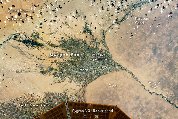
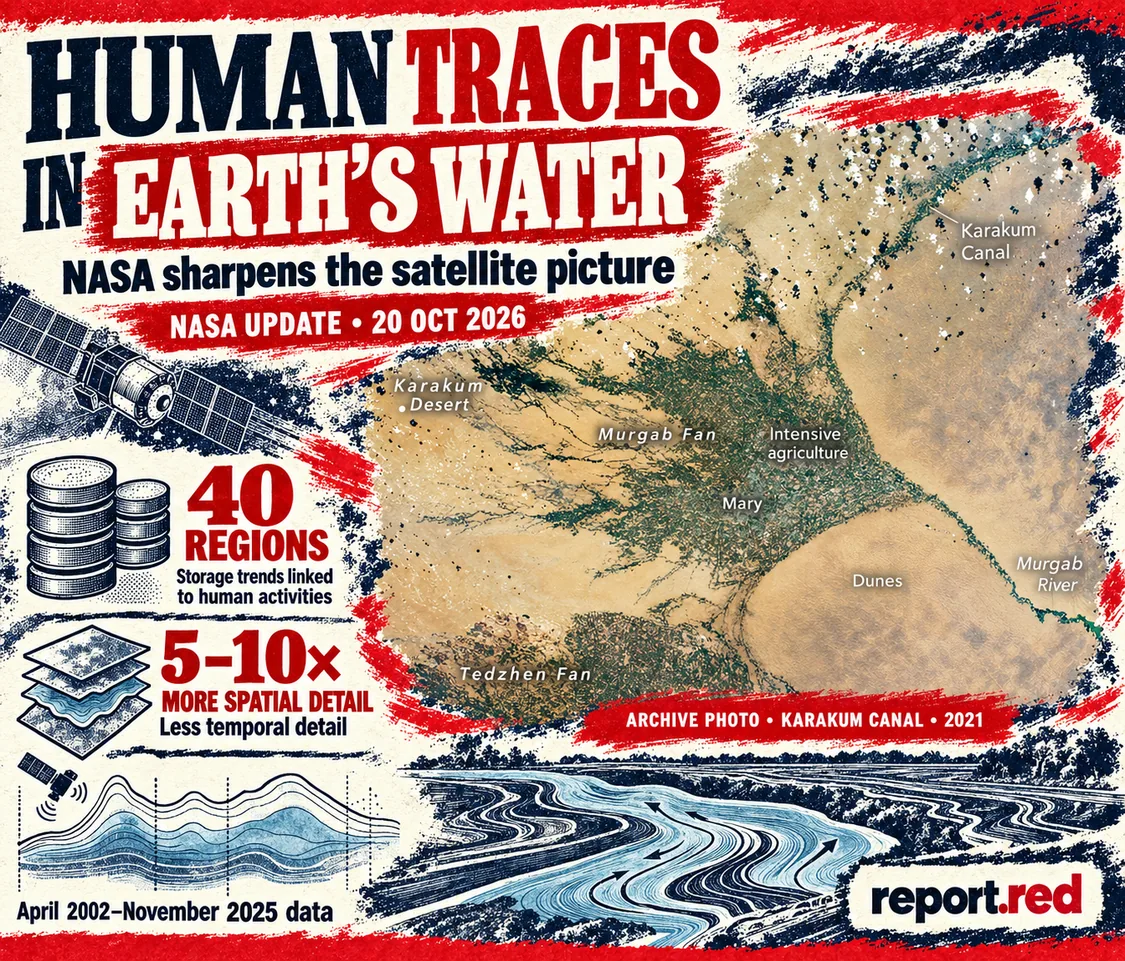
NASA’s account links groundwater-irrigated farmland with storage declines in places including California’s Central Valley and northern India. Reservoir filling and water diversion can produce a different signal. The agency highlights storage gains around Turkmenistan’s largely unlined Karakum Canal, where diverted water can seep into the ground.
This distinction matters because terrestrial water storage includes water in multiple parts of the landscape, rather than a single measure of usable groundwater. A storage gain cannot by itself establish that a supply is clean, sustainably managed or equally accessible to nearby residents. Likewise, identifying a region with a human-related statistical signal does not mean climate has stopped influencing it.
How readers should use the finding
The study can help researchers and water managers identify places where human activity deserves closer examination alongside climate. It does not establish the condition of an individual well, replace local measurements or turn an association into experimental proof of causation. NASA says the researchers want to recover more temporal detail and better separate local effects from effects originating elsewhere.
The 40 regions are regions identified in this analysis, not a count of every water crisis worldwide. The cover’s 2021 astronaut image illustrates the canal setting and is separate from the 2026 publication and the satellite-data period. This article is based on NASA’s original account and mission documentation; it does not claim a field investigation or independent reanalysis of the study’s data.
More science reporting from report.red
Archive astronaut photograph: Karakum Canal and surrounding agriculture, Turkmenistan, 13 June 2021, ISS065-E-111045. Expedition 65 crew / NASA Johnson Space Center. This is contextual imagery, not a 2026 water measurement. NASA public-domain material; no NASA endorsement implied. Expedition 65 crew / NASA Johnson Space Center, ISS Crew Earth Observations Facility · NASA public-domain photograph; editorial use under media guidelines. ImageGen / report.red.